

| Part #: | |
|---|---|
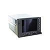
| Model: | GPS-500W |
| Desc: | WAAS GPS System |
| OEM: | Garmin |
| NSN: | |
|---|---|
| Sched-B: | 8526910030 |
| ECCN: | |
| Cage Code: | 0TRC3 |
| Price | Condition | Availability | Stock Info | |
|---|---|---|---|---|
| Price | Cond. | Avail. | Stock Info | |
| REQUEST | SV OUTRIGHT | REQUEST LEAD TIME |
|
|
| REQUEST | SV EXCHANGE | REQUEST LEAD TIME |
|
| Price | Condition | Availability | Stock Info | |
|---|---|---|---|---|
| Price | Cond. | Avail. | Stock Info | |
| REQUEST | SV OUTRIGHT | REQUEST LEAD TIME |
|
|
| REQUEST | SV EXCHANGE | REQUEST LEAD TIME |
|
| Price | Condition | Availability | Stock Info | |
|---|---|---|---|---|
| Price | Cond. | Avail. | Stock Info | |
| REQUEST | SV OUTRIGHT | REQUEST LEAD TIME |
|
|
| REQUEST | SV EXCHANGE | REQUEST LEAD TIME |
|
| Price | Condition | Availability | Stock Info | |
|---|---|---|---|---|
| Price | Cond. | Avail. | Stock Info | |
| REQUEST | SV EXCHANGE | REQUEST LEAD TIME |
|
| Price | Condition | Availability | Stock Info | |
|---|---|---|---|---|
| Price | Cond. | Avail. | Stock Info | |
| REQUEST | SV OUTRIGHT | REQUEST LEAD TIME |
|
|
| REQUEST | SV EXCHANGE | REQUEST LEAD TIME |
|
| Price | Condition | Availability | Stock Info | |
|---|---|---|---|---|
| Price | Cond. | Avail. | Stock Info | |
| REQUEST | SV EXCHANGE | REQUEST LEAD TIME |
|
- WAAS Certified GPS with color moving map and includes the features of the GNS-530W without Nav & Comm
- Big picture situational awareness, WAAS navigation & interface capabilities
- 5-inch high-contrast display, direct sunlight viewable
- Complies with WAAS TSO C146a "sole means" navigation
- Provides vertical and lateral approach guidance to thousands of US airports
- Approved to fly LPV "glideslope" approaches w/out reference to ground-based navaids
- Advanced 15-channel receiver, including 3 WAAS, with update rate of 5 per second
- See your position relative to ground features, chart data, navaids, flight plan routings, approach procedures and more
- Integrates built-in terrain and navigation databases
- Jeppesen database, updated with front-loading data cards, contains location reference for all airports, VORs, NDBs, Intersections, Flight Services Stations, published approaches, SIDs/STARs, Special Use Airspace and geopolitical boundaries
- Detailed basemap shows airports, cities, highways, railroads, rivers, lakes, coastlines & more
- One box design with simple operation
- User-configurable display
- Separate internal battery protects stored data for up to five years
- Easy to interface w/a variety of optional sensors & tracking systems
- Includes basemap, US Terrain & Obstacles database, and Navigation database
- Jeppessen data types include full and non-precision approaches, DPs and STARs
- Navigation database cover areas include Americas, International or Worldwide
- Accuracy of 1 meter RMS lateral typical, 2 meter vertical, with WAAS
- Acquisition time 1:45 minute typical (cold), 10 seconds reacquisition
-
Nav Features Include: Navigation with flight plans and direct-to waypoints, approach navigation using published approaches stored on the NavData card, terminal navigation using DPs and STARs from NavData card, closest point of flight plan, arrival and departure frequencies, turn advisories and arrival annunciations
- Planning Features Include: Trip and fuel planning, true air speed, density altitude, winds aloft, flight timers, trip statistics, checklists, sunrise and sunset, RAIM availability, advisory vertical navigation (VNAV)
- Interfaces Include: ARINC 429, RS-232, CDI/HSI, RMI (digital), altitude input (serial: Icarus, Shadin-Rosetta; encoded Gillham/gray code), fuel sensor, fuel/air data, GDL 69/69A XM, GTX 330/33D, L-3 Stormscope, L-3 Skywatch, Ryan TCAD, GAD 42, and others
- Map Datums: WGS-84
- With Optional subscription to XM WX Satellite Weather & optional GDL 69 or 69A datalink receiver NEXRAD, METARs, TAFs, lightning and more can be laid directly over Jeppesen and topographic map databases
- With additional monthly service fee, GDL 69A provides XM Satellite Radio
- Add GTX 330 Mode S Transponder and the GPS will also display TIS alerts
- Can be upgraded with optional Class B TAWS alerting
Additional Information: Click Here for the Quick Reference Guide Click Here for the Pilots Guide
SPECIFICATIONS
| Unit Dimensions: | 6.25"W x 4.60"H x 11"D | Display Size: | 4"W x 3"H |
| Display Resolution: | 320 W x 234 H pixels | Display Type: | 8 color TFT LCD |
| Weight: | 6.8 lbs | Voltage Range: | 14-28 |
| Built-in VHF Comm: | no | Transmit Power: | no (VHF comm not included) |
| Built-in VOR/Loc/GS: | no | Receiver: | 12 channel |
| IFR or VFR: | IFR | Basemap: | yes |
| Waypoints: | 1000 | Flight Plans: | 20 reversible; up to 31 waypoints each |
| Dynamics: | 1000 knots max | GPS: | TSO-C146a, Class 3 |
| VOR: | TSO-C40c | LOC: | TSO-C36e |
| GS: | TSO-C36e |
| Part Number: | Description: |
|---|---|
| 011-01062-00 | WAAS GPS System, Black |
| 011-01062-10 | WAAS GPS System, Gray |
| 011-01062-40 | Black, upgraded from non-WAAS unit |
| 011-01062-50 | Gray, upgraded from non-WAAS unit |
| 011-01063-00 | WAAS GPS System, Black w/ TAWS |
| 011-01063-10 | WAAS GPS System, Gray w/ TAWS |
| 011-01063-40 | Black w/ TAWS, upgraded from non-WAAS unit |
| 011-01063-50 | Gray w/ TAWS, upgraded from non-WAAS unit |
NSN: 5826-01-562-7986
| Price | Condition | Status |
|---|---|---|
| REQUEST | SV OUTRIGHT | REQUEST LEAD TIME |
| REQUEST | SV EXCHANGE | REQUEST LEAD TIME |
NSN: 5826-01-562-7986
| Price | Condition | Status |
|---|---|---|
| REQUEST | SV OUTRIGHT | REQUEST LEAD TIME |
| REQUEST | SV EXCHANGE | REQUEST LEAD TIME |
| Price | Condition | Status |
|---|---|---|
| REQUEST | SV OUTRIGHT | REQUEST LEAD TIME |
| REQUEST | SV EXCHANGE | REQUEST LEAD TIME |
NSN: 5826-01-594-5306
| Price | Condition | Status |
|---|---|---|
| REQUEST | SV EXCHANGE | REQUEST LEAD TIME |
| Price | Condition | Status |
|---|---|---|
| REQUEST | SV OUTRIGHT | REQUEST LEAD TIME |
| REQUEST | SV EXCHANGE | REQUEST LEAD TIME |
| Price | Condition | Status |
|---|---|---|
| REQUEST | SV EXCHANGE | REQUEST LEAD TIME |
Click on a question below to see the answer. If you have a question about this model that is not answered below, please contact questions@seaerospace.com
Can you please explain in detail the difference between Garmin part numbers that begin with 010 versus Garmin part numbers that begin with 011?
Southeast Aerospace has created a document that explains in detail the difference between the 010 vs. 011 part numbers.
Please see link: SEA-Garmin-010-and-011-FAQ.pdf
Why do some parts indicate "REQUEST" or “RFQ” on the Southeast Aerospace website?
In relation to NE (New) parts, many OEMs change their prices and availability without any notice to dealers or the industry. Therefore, through the REQUEST or RFQ indication, we ask that customers contact us for the most accurate price and availability.
In relation to SV & OH parts, the used parts aftermarket in the aviation industry is not an infinite supply. It is a dynamic, constantly changing market that is significantly affected by and susceptible to highs and lows in supply and demand. Therefore, although we attempt to, at times, we are unable to predict the exact moment when an item may be available. Once again, through the REQUEST or RFQ indication on our website, we ask that customers contact us for the most current and accurate price and availability.
How can I safely clean and disinfect my Garmin avionics?
Garmin has provided Service Advisory 2051 for general recommendations, materials, and supplies to clean and disinfect Garmin products. Otherwise, not following the recommendations could void the warranty.
- Cleaners containing ammonia will harm the anti-reflective coating on many Garmin aviation display lenses.
- Disinfectant with a solution of 70% isopropyl alcohol that does not contain ammonia is preferred. Solutions of up to 91% isopropyl alcohol are also acceptable.
- Clean the display lens using a clean lint-free cloth and a cleaner that is specified as safe for anti-reflective coatings.
- For other exposed surfaces such as knobs, buttons, and bezels, a damp cloth with soap and water is acceptable.
- Bleach-based cleaners, ammonia-based cleaners, or other harsh chemicals on any surface are not recommended.
- Remove all soap/soap residue to prevent buttons and knobs from gumming up or becoming slippery.
- Many aviation products are not rated as waterproof. Spraying or wetting the units to the extent where moisture could go beyond the exterior surfaces could damage the unit.
Why does the traffic thumbnail for my 400 or 500 series aviation device say "See Map"?
Traffic can be displayed in two different map views on the 400 and 500 series aviation devices. The thumbnail view is always in a track-up reference while the map view can be in either a track-up or north-up reference. To see traffic simultaneously on the map and on the thumbnail, the orientation of the map must be set to track-up. Otherwise, traffic will only be shown on the map and the thumbnail will say "See Map".
What is the difference between the legacy 400/500 series units and the WAAS 400W/500W series units?
The WAAS systems have the same capabilities as the 400/500 systems plus a few more. With the WAAS signal being acquired, the GPS can give vertical guidance to a runway similar to an ILS glide slope indication. The WAAS units have added display capability when connected to our GDL 69(A) XM Satellite weather/radio receiver. They also have additional ARINC 424 leg types to guide a compatible autopilot through procedure turns and published holds.
Why is the altitude on my GPS-500W different than the altitude on my altimeter?
An altimeter does not measure altitude on the Garmin GPS device. The altimeter in the aircraft measures air pressure. The altimeter is calibrated to display a certain change in altitude based on a change in air pressure. For every inch of mercury pressure change, the altimeter displays a change of approx. 1000 ft. of altitude. The GPS does not use air pressure to determine altitude and is not subject to the pressure errors in determining altitude. Therefore, the GPS derived altitude is almost always more accurate than an altimeter. Since everyone uses a pressure-based system to determine altitude, it is integral to utilize a pressure sensitive altimeter to ensure required vertical separation.
What is the difference between the classic Garmin GNS-400/500 GPS/Nav/Comms and the GNS-400W/500W units?
For a complete summary of the feature changes and enhancements, click Here.
Where can WAAS approach-capable GPS navigators be operated?
Are the S-Tec autopilots capable of flying WAAS approaches from the Garmin GNS-430/530W WAAS series systems?
For the S-Tec System 20 or 40, these systems are roll axis only. However, if equipped with a GPSS converter, these systems will follow the lateral steering commands from the GPS for a WAAS approach. Vertical guidance is pilot controlled.
For the S-Tec System 30 or 50, these systems are roll axis and altitude hold only. However, with a GPSS converter, these systems will follow the lateral steering commands from the GPS for a WAAS approach. Vertical guidance is pilot controlled.
For the Systems 55, 55X, 60-2, 60PSS, or 65, these systems will track the lateral deviation from the GPS navigator in the Approach (APR) mode and the vertical deviation in the Glideslope (GS) mode. If you are using a 55X or other autopilot systems equipped with a GPSS converter, they will not couple to a WAAS approach in GPSS mode. To follow both the vertical and horizontal deviations of a WAAS approach, the autopilot must be in Approach (APR) mode and Glideslope (GS) mode. The 60PSS system is pitch axis only and will follow the vertical deviation in Glideslope (GS) mode.
What are the issues for interfacing the WX-500 Stormscope with Garmin WAAS GPS receivers?
Will the new Garmin 400W/500W series WAAS units work with my EFIS?
Honeywell EFIS 40/50 with the SG 465 symbol generator with the following limitation: No vertical guidance is provided for GPS approaches.
Sandel SN3308 with the following limitation: GPS lateral and vertical guidance is provided using the analog interface.
Sandel SN3500 with the following limitation: Vertical guidance is provided for GPS approaches.
This is specified in the latest Garmin 400W series installation manual P/N 190-00356-02 Rev. C, dated April 2007.
How do I update the database in my Garmin GPS?
For handheld GPS receivers, database updates can be ordered and downloaded directly through Garmin's Internet site.
For panel mount GPS receivers, all database cards and computer downloads (if applicable) must be ordered through Jeppesen. Contact Jeppesen at www.jeppesen.com for more information.
How do Garmin GNS-400/500 series part numbers change when upgraded to WAAS?
Do the Garmin GNS400/500 series navigators meet BRNAV requirements?
What is the difference between Terrain Advisory and TAWS?
What is the meaning of the N in some Garmin part numbers?
